

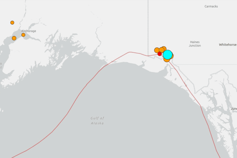
A 7.0 magnitude earthquake struck near Yakutat, Alaska Saturday, the United States Geological Survey (USGS) reported.
The quake came during a cluster of seismic activity that saw over a dozen other earthquakes reported over a 24-hour period in the region on the border of Alaska and Canada’s Yukon Territory, the USGS map shows.
The earthquake hit at a depth of around 6 miles, or 10 km, which means it was felt closer to the surface. That was reflected in the number of people who self-reported the quake on the USGS website.
No immediate information was available on possible injuries or damage, and no tsunami warnings have been issued.
What To Know
The USGS reported that the quake’s epicenter was located about 56 miles from Yakutat, a community with a population of around 660 people, and roughly 230 miles northwest of Juneau.
The earthquake struck at a shallow depth of about six miles, around 10 km, which allowed the shaking to be more acutely felt at the surface. Residents across the region and into parts of Canada reported feeling the earthquake, though its remote location limited the human impact.
Initial data indicated no immediate casualties, property damage, or power outages, and no tsunami warning was issued following the event.
The USGS also reported aftershocks in the vicinity, which is typical after a seismic event of this magnitude.
Alaska routinely experiences more significant earthquakes than any other U.S. state due to its position along the seismically active Pacific “Ring of Fire.”
According to NASA’s Earth Observatory, Alaska is struck by frequent seismic events because of interactions between the Pacific Plate and the North American Plate.
Historically, the state has been the site of some of the world’s most powerful earthquakes, including the 1964 Great Alaska Earthquake, which measured a magnitude 9.2—making it the second largest earthquake ever recorded globally.
The region also experienced a major 8.7 magnitude quake in the Rat Islands in 1965—a testament to the ongoing seismic threat. The largest earthquake ever recorded globally was the 1960 9.5-magnitude Valdivia Earthquake in Chile
Earthquake magnitudes are measured on a logarithmic scale called the Moment Magnitude Scale. Each whole number increase reflects a tenfold jump in measured amplitude, meaning a magnitude 7.0 event is ten times more powerful than a 6.0.
Michigan Technological University notes that magnitude 7.0–7.9 earthquakes are categorized as major, often resulting in serious damage where populations and infrastructure are present.